Our customised data solutions are developed to gather accurate data, visualize insights and bring speed and precision to your engineering work. With selection from a diverse range of UAV platforms, payloads and data analysis system & visualization software, we provide accurate solutions specific to all industry.
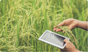
Minimise all risk and Maximize crop yields through routine observation of crop colour, heat radiation, density and other early symptoms of infection or poor health. Identify optimal harvest patterns by tracking crop growth rates and identifying produce maturity.
Get access to high-definition visual data that can bring you a clear picture of the extent of damage and help you to plan your next steps.

Detect nuances of in-field variability that can help your strategy around the condition & health of your crops. Meet your critical goal of improved crop yield estimation with our crop analysis service.
Get clear and concise visual data on how to plan tillage for the best crop yield. Have multispectral images that help you to calculate indexes and plan for irrigation based on regular or irregular environmental changes.
UGet a realistic view of the number of crops and trees in your agricultural field. We generate and analyse all high-definition images and videos of your entire farm area that help for further planning.

Get ahead of possible damages through visual records that can have your back when you need it the most. With multispectral and high quality images, analyses of damages your action around next steps improve.